Headquarters
The Energy and Resources Institute (TERI)
Darbari Seth Block, Core 6C,
India Habitat Centre, Lodhi Road,
New Delhi - 110 003, India
The fully automated system, which uses advanced hydrological models to provide warning with a lead time of 72 hours, is replicable across India.
New Delhi, 13 August 2020: The Energy and Resources Institute (TERI) and National Disaster Management Authority (NDMA) have launched a Flood Early Warning System (FEWS) for Guwahati to alert local authorities about flash floods and/or heavy rainfall. Launched at an online event, the fully automated web-based tool will help them take timely and appropriate measures in event of a natural disaster heading toward the city.
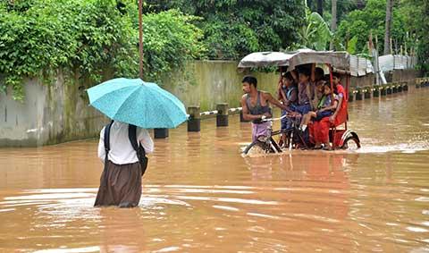
Developed under TERI's project supported by the NDMA in collaboration with the India Meteorological Department (IMD) and the Assam State Disaster Management Authority (ASDMA), the tool can be replicated to predict urban floods in any part of the country. The FEWS pilot project was undertaken on an experimental basis, to enhance resilience for urban floods, in assistance with the Guwahati Municipal Corporation, North Eastern Space Applications Centre (NESAC) and TERI School of Advanced Studies (TERI SAS). This is in line with Prime Minister Narendra Modi's recent statement during a meeting with the Chief Ministers of six states—Assam, Bihar, Uttar Pradesh, Maharashtra, Karnataka and Kerala—wherein he highlighted the need for development of local-level flood warning system.
Speaking at the launch event, Dr Ajay Mathur, Director General, TERI said, "Nature-based risks can now be integrated into early warning system, which is how FEWS is designed. Together with science communication, the results of these assessments can enhance the resilience of flood-prone cities and geographies in the country. We are delighted that our FEWS assessments can provide a flood management roadmap for cities that have perennial issues of urban flooding."
Shri G V V Sarma, Member Secretary, National Disaster Management Authority (NDMA) said, "The expectations of the civil society on the disaster management apparatus is increasing every day. Despite many advances in science and technology, a lot of work remains to be done. Along with early warning system, we need techno-legal measures on ground such as protection of water bodies, solid waste management and cleaning of drainage channels ahead of the monsoon."
"All state and districts are statutorily required to have their disaster management plans in consonance with National Disaster Management Plan 2019. They should make use of tools such as Early Warning System", he further added.
Shri B P Yadav, DGM – Hydrology, IMD New Delhi talked about building flood forecasting capabilities at the local level. "We have categorised the country into 27000 watersheds, and based on it we issue flood warnings. With increasing incidents of urban flooding, our main focus is to develop local city-specific forecasting systems for accurate advisory. Currently there are 25 Doppler Weather Radars in India to detect/predict likelihood of high-intensity rainfall events. IMD will install 20 radars in hill districts in the Eastern and Western Himalayas in the next 2 years."
FEWS uses IMD's weather research forecast (WRF) model results of precipitation at 3 Km spatial resolution having hourly data set to simulate the hydrodynamic model for flood prediction and sends out early warning.
Explaining the features of FEWS, Prasoon Singh, Project Lead and Associate Fellow, Earth Science and Climate Change, TERI said, "Early warning systems have proven to be an effective tool in reducing our vulnerabilities toward predicting natural disasters. Though assessing recurring events such as floods is complex due to multiple levels of interactions and dynamic nature of urban water system, tools such as FEWS, can be customised to incorporate such uncertainties, thereby improving our resilience against urban flooding."
"The system is developed with an inbuilt urban drainage to predict flood at street-level accuracy. The flood level and hotspot areas can be visualised over Google Maps which will help in identifying flood-affected areas, disaster preparedness, and management of urban flooding related issues such as traffic disruption, providing relief and recovery, and managing storm water," he added. The online discussion also showcased a climate portal developed by TERI's Centre for Climate Modelling that assists policy makers to visualize pan-India information on past and future climate variability at city-scale to assist climate-resilient planning. TERI's hydro-climate modelling capacities are constantly trying to address the science and policy gaps by provisioning innovative technologies.
The Energy and Resources Institute (TERI) is an independent, multi-dimensional organisation, with capabilities in research, policy, consultancy and implementation. It has pioneered conversations and action in the energy, environment, climate change, and sustainability space for over four decades.
The institute's research and research-based solutions have had a transformative impact on industry and communities. Headquartered in New Delhi, it has regional centres and campuses in Gurugram, Bengaluru, Guwahati, Mumbai, Panaji, and Nainital, supported by a multi-disciplinary team of scientists, sociologists, economists and engineers, and state-of-the-art infrastructure.
For further information, contact:
TERI – Dhawal Trivedi: dhawal.trivedi@teri.res.in
Edelman – Rakhi Aurora: rakhi.aurora@edelman.com