In the first few decades since Independence, disaster response in India was traditionally concerned with relief and rehabilitation during the post-disaster period. It was only following the 1999 Odisha super cyclone and the 2001 Bhuj earthquake that disaster management in India came into maturity. In this article, Dr Rina Mukherji traces the growth of disaster response and its evolution in India, over the years.
Climate Change, increased greenhouse gas (GHG) emissions, and global warming have contributed to an increased frequency and intensity of natural disasters worldwide. At a time when the world is already grappling with the COVID-19 pandemic, a range of disasters worldwide have made matters worse for the poor and vulnerable, particularly in the developing world. In India, Cyclone Amphan is the best example of how overlapping disasters can take a heavy toll on those living below the poverty line.
Disaster Management in India
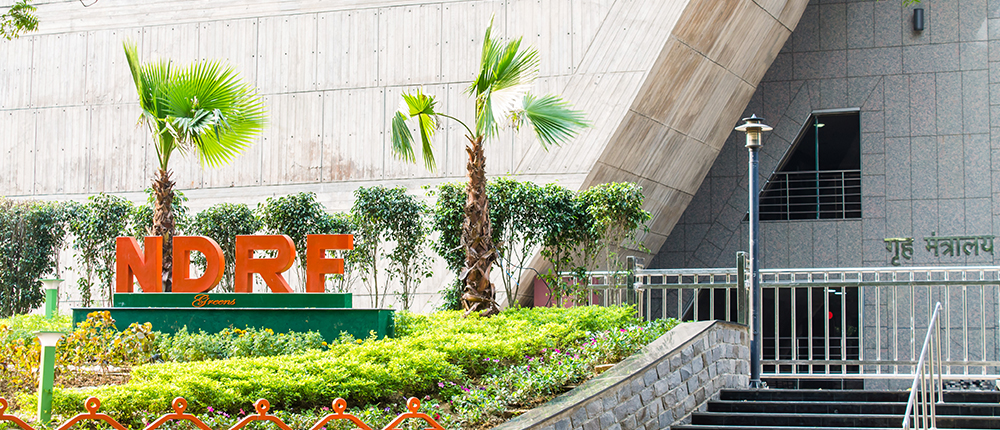
In the first few decades since Independence, disaster response in India was traditionally concerned with relief and rehabilitation during the post-disaster period. It was only following the 1999 Odisha super cyclone and the 2001 Bhuj earthquake that disaster management in India came into maturity. Realization dawned that investments in mitigation are much more cost-effective than expenditure on relief and rehabilitation. This culminated in the National Disaster Management Act (NDMA), 2005 and a National Disaster Response Force (NDRF). Today, we have a three-tier system wherein a District-level Disaster Response Force, a State-level Disaster Response Force, and the NDRF jointly deal with any calamity.
This multi-pronged system saw Cyclone Phailin tackled with just 22 deaths (all from indirect factors), as against a toll of 10,000 left behind by the Odisha super cyclone.
Disaster Response and its Evolution in India
Natural disasters in India fall into several categories such as floods, earthquakes, droughts, cyclones, avalanches, glacial lake outburst floods (GLOFs), and landslides.
Floods in India
A flood is defined as the rising and overflow of water into land, which is normally dry. Floods are generally caused by rivers outflowing their banks following heavy rains, or due to a rise in the river bed owing to heavy siltation, or some other natural disaster.
The Government of India initiated measures to deal with floods, for the first time, following the devastating floods of 1954. In subsequent decades, the Brahmaputra Board (1980), the Ganga Flood Control Commission (1972), and the Farakka Barrage Control Commission were set up. In 1980, the Rashtriya Barh Aayog (National Floods Commission) studied the phenomenon of floods in different regions of the country, and declared around 40 million hectares as flood-prone. Subsequent Committees under the X and XI five-year plans revised the figure to 45 million hectares.
In 2008, the NDMA issued guidelines for flood management, wherein specific roles of the Central and State agencies were defined, and flood mitigation and relief measures spelt out. Subsequently, the Flood Plain Zoning Act, 2012 was drawn, wherein building and other related activities were to be kept away from the flood plains of rivers.
Earthquakes
An Earthquake is a shaking or trembling of the earth, which is volcanic or tectonic in origin. According to the Government of India, "...about 60 per cent of the landmass is prone to earthquakes of various intensities every year." The Bureau of Indian Standards has divided the entire Indian landmass into four seismic zones, as per their vulnerability to seismic waves/earthquakes: Zone V is made up of the regions at very severe risk from/most vulnerable to earthquakes, while Zone IV comprises regions at severe risk, Zone III is made up of regions at moderate risk, and Zone II is made of regions that have low risk of damages from earthquakes. There is no part of India that falls in Zone I.
Prior to the 2001 Bhuj earthquake, the emphasis lay on rehabilitation and relief, with the Ministry of Agriculture of the Government of India being the nodal ministry for natural disasters. From July 2002, the Ministry of Home Affairs (MHA) was made the nodal ministry for disaster management. Since then, a National Emergency Management Authority has been set up, with a National Core Group for Earthquake Disaster Mitigation to advise on various tasks associated with earthquake risk reduction. The MHA has initiated a Disaster Risk Management Programme to address the vulnerabilities of 169 districts in 17 states with the United Nations Development Programme (UNDP). An Urban Earthquake Vulnerability Reduction Programme (UEVRP) has also been launched by the MHA and UNDP in 38 cities of the country: these cities have been chosen on the basis of the seismic zones they are in, and their respective populations [that is, zone III and above and populations of more than 500,000].
After the 1999 Chamoli earthquake, the Government of India had set up a "High Powered Committee on Disaster Management". The initial mandate of this committee (that is, natural disasters), was expanded to include man-made disasters. Submission of its report by the Committee in October 2001 helped generate better understanding within the central government on disaster issues, and eventually, the Tenth Five Year Plan (2002–07) had a separate chapter on disasters—"Disaster Management: The Development Perspective" for the first time ever. Several states are now taking a keen interest in disaster management: Uttarakhand has a separate Ministry for Disaster Management, while Gujarat has the Gujarat State Disaster Management Authority (GSDMA). Both states have also passed disaster management acts.
Although India was one of the first countries to bring in a National Building Code in 1970, and introduced comprehensive guidelines for earthquake-resistant building technology (as per the revised National Building Code brought into force in 1983), following these rules was not mandatory. In 2005, the National Building Code underwent a thorough revision. The latest earthquake code –'Criteria for earthquake-resistant design of structures: Part 1, General Provision and Buildings,' has now to be duly adhered to in seismic zones of the country.
The Home Ministry's National Disaster Management Division runs a National Programme for Capacity Building of Architects in Earthquake Risk Management. This effort is supplemented by state governments and institutions that focus on structural engineers.
Droughts
Drought is a state of prolonged shortage of water. A drought results in (i) shortage in food production due to failure of crops; (ii) shortage of water for human consumption; (iii) shortage in fodder and drinking water for cattle, migration of livestock populations, and even a decrease in the animal population; (iv) shortage in resources for agricultural operations during the subsequent year as a result of the decrease in the animal population; and (v) deforestation to meet the fuel shortage for cooking in rural areas because of non-availability of agricultural wastes and crop residues.
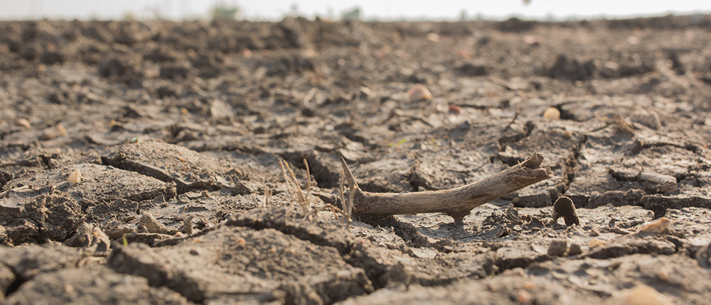
Realizing that short-term measures centred around relief and rehabilitation can never root out the problem of drought in drought-prone regions, the National Institute of Disaster Management (NIDM) came up with several recommendations in its manual in 2009. Under the new system, scientific advances in climate forecasting, information and telecommunications technology went hand-in-hand with participatory democracy to develop a system of monitoring and managing drought. This was used to come up with crop contingency plans and watershed development programmes. Today, village communities in drought-prone parts of India access weather data from the India Meteorological Department (IMD) using updates disseminated through cell phones, to plan out crops. Aquifer mapping helps communities assess their groundwater reservoirs, and helps them tide over water shortages in the absence of rain. There is also a return to drought-resistant traditional crops that can withstand extremes of weather and erratic rainfall patterns.
Cyclones
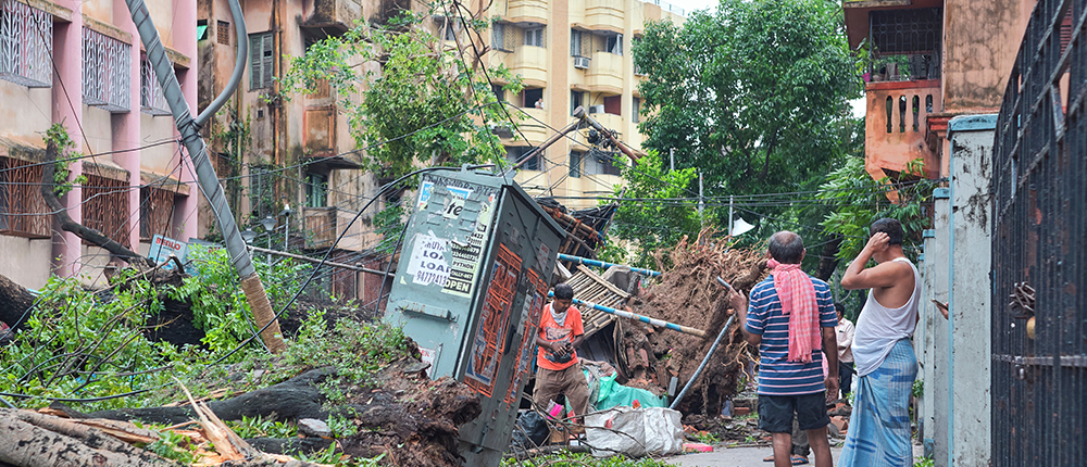
A cyclone is a system of winds that rotates around a centre of low pressure and advances rapidly to bring heavy rain. Tropical cyclones are devastating storms that bring in storm surges, which cause massive losses to life and property. Tropical cyclones hitting India have primarily had their origins in the northern Indian Ocean region. As compared to the rest of the world, these cyclones are marked by higher storm surges, and show their peak periods twice a year. India's eastern seaboard—comprising the coastal plains of West Bengal, Odisha, and Andhra Pradesh—have borne the brunt of most cyclones hitting India.

However, it was the 1999 Odisha supercyclone, with its huge toll of human lives that proved a shot in the arm for disaster management in India. Cyclone management, which was embarked on a war footing under a multi-pronged programme (particularly since 2009), has since been a rare success story in India.
This has involved revamping technology for forecasting and tracking impending cyclones, and estimation of resulting storm surges (which are particularly responsible for the loss of lives in the aftermath of a cyclone). It has also meant better coordination between central and state agencies, as also the various stakeholders involved. The IMD has utilized advanced models developed by the Indian Institute of Technology (IIT) Delhi, Indian National Centre for Ocean Information Services (INCOIS) (Hyderabad) for forecasting storm surges, while using advanced strategies to disseminate information through hourly updates over radio, television, email, social media networks, port authorities, and the control room of the National Disaster Management cell of the Ministry of Home Affairs. Warning dissemination has also made use of the satellite-based Cyclone Warning Dissemination System (CWDS), Aeronautical Fixed Telecommunication Network (AFTN), Interactive Voice Response System, besides daily press releases and conferences with the print and electronic media. In the matter of evacuation too, state and central agencies have coordinated with local bodies to move people out of places at risk, keeping casualties at a minimum.
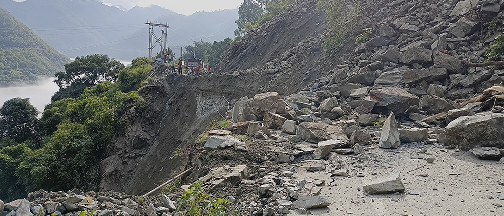
Avalanches and GLOFs
An avalanche is a swift movement of ice, snow, rock, earth or other material down a mountainside or over a precipice. A GLOF is a sudden release of water from a lake fed by glacier melt that has formed beneath, within, in front, or at the side of the glacier. An avalanche can trigger a flash (sudden) flood or a GLOF to wipe off entire mountain villages and everything else in its path.
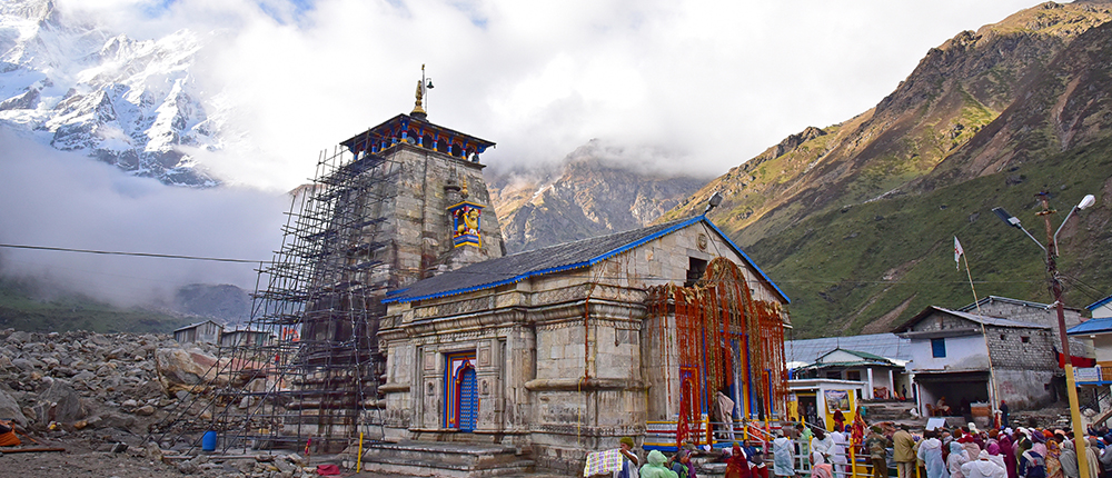
In June 2013, unusually heavy rainfall in Uttarakhand melted the Chorabari glacier, causing a flash flood. The Chorabari Lake overflowed its banks, resulting in a flash flood and swelling of the Mandakini River. Massive landslides and floods killed 5000 people, destroying thousands of houses and property in the Kedarnath valley.
The January 2017 Gurez Avalanche was a series of four avalanches to occur in the Kashmir Valley, following multiple spells of heavy snowfall. The first avalanche claimed 24 lives, including 20 soldiers. This was followed by another avalanche in Sonmarg followed by two more avalanches that hit Gurez, killing many soldiers.
In February 2021, an avalanche at Joshimath in Chamoli district in Uttarakhand saw a glacier break off. A huge inflow of water in the Rishiganga River that followed saw the destruction of the Rishiganga and Tapovan-Vishnugad hydel projects that were under construction. Many workers and their supervisors were swept off by the waters, resulting in a massive loss of lives.
The Himalayas are one of the youngest mountains in the world, and hence extremely unstable. The region feeds three major riverine systems—the Ganges, the Indus and the Brahmaputra—that support more than 2 billion people. It is home to 9575 glaciers, many of which feed several large and small rivers in south and east Asia. Stretching from Jammu and Kashmir in the west, up to Arunachal Pradesh in the East, the region is a biodiversity hotspot and houses an extremely fragile ecosystem.
Taking these factors into account, the National Mission for Sustaining the Himalayan Ecosystem (NMSHE) was launched under the aegis of the National Action Plan on Climate Change (NAPCC) in 2014. The NMSHE has task forces to look after the following:
- Natural and geological wealth
- Glacier and water
- Biodiversity
- Himalayan agriculture
- Traditional knowledge
Each task force is coordinated by one lead institution, with a network of other institutions supporting it. Some lead institutions working with NMSHE are the G B Pant Institute of Himalayan Environment, the Wildlife Institute of India (WII), Indian council of Agricultural Research (ICAR), Jawaharlal Nehru University (JNU), National Institute of Hydrology (NIH), and the Wadia Institute of Himalayan Geology. The Mission covers Jammu & Kashmir, Himachal Pradesh, Uttarakhand, Sikkim, Arunachal Pradesh, Nagaland, Manipur, Mizoram, Tripura, Meghalaya, Assam and West Bengal, and has already set up state climate change cells in each of them.
Inadequacies in the System for Tackling Disasters
In spite of the government's current emphasis on disaster mitigation, a holistic approach to disasters remains a crying need. For instance, immediately after the 2013 Uttarakhand tragedy, the government embarked upon a recovery plan with the help of the Joint Rapid Damage and Needs Assessment (JRDNA) Mission set up with the help of the World Bank and the Asian Development Bank (ADB). The Mission laid the groundwork for recovery and reconstruction and collaborated with the Government of Uttarakhand for the Uttarakhand Disaster Recovery Project. The Project hinged on structural mitigation, but ignored disaster education, awareness generation and training or revival of local/indigenous early warning systems, besides post-trauma counselling.
There is also an urgent need to incorporate the latest technology to mitigate disasters, as was amply demonstrated in India's handling of cyclones. The Web Flood Risk Information System (WebFRIS), a flood risk information system developed for the first time ever in India, at IIT Mumbai, can provide precious ground-level information in a simplified form to a wide audience. This can prove immensely helpful for both government bodies and local citizens.
Disaster mitigation demands striking at the root causes behind natural disasters, and learning from past experience. Deforestation has been found to trigger droughts, since trees play an important role in recharging groundwater reservoirs. Trees also regulate local temperatures, and bind the soil; hence, cutting down forests can contribute to warming and trigger landslides. In Kerala, years of deforestation resulted in heavy landslides when unusually heavy rains struck in 2018, killing 410 people, and rendering 1 million people homeless. Deforestation in Uttarakhand triggered the Kedarnath tragedy due to global warming and heavy rains in 2013. Yet, the government refuses to learn from what has befallen us in the past. The recent move to cut down 2700 sal trees in the Rajaji National Park to widen the Delhi–Dehradun highway by the National Highways Authority of India (NHAI) is a case in point.
Mangroves are known to shield our coasts from cyclones and tsunamis; yet, mangrove forests continue to be illegally felled all over the Indian Sundarbans in West Bengal. As a result, Cyclone Aila and the recent Cyclone Amphan wreaked havoc as far as the city of Kolkata.
Corruption, bribery and a strong builders' mafia often compel officials to ignore the 2012 Flood Plain Zoning Act, which is meant to prevent any structures coming up in the flood plains of rivers. Thankfully, the National Green Tribunal took a dim view of the violations in the Yamuna flood plains and ordered the demolition of all illegal structures in May 2013.
It is also imperative that we revisit our developmental priorities if disasters are to be avoided. In July 2014, heavy rainfall caused a major landslide in the ecologically sensitive Malin village of Ambegaon taluka in Pune district, killing 153 people, burying 70 homes and destroying an entire tribal village. The reason, according to environmentalists, was deforestation, unscientific terracing of the hillside to grow wheat that weakened the soil, and the effect of the backwaters of Dimbhe Dam built nearby. Notwithstanding what happened, the hills in the Western Ghats around the Mumbai–Pune Expressway/old Mumbai-Pune road continue to see deforestation and frenetic building activity by realtors, while landslides keep plaguing motorists during the monsoons, taking precious lives.
The February 2021 Rishiganga tragedy that killed and swept off more than 200 workers is another catastrophe triggered by a string of hydroelectric projects in an ecologically-sensitive region that was found warming much faster than the global average (as per the Divecha Centre of Climate Change, Bangalore). A dire warning sounded by a PIL petition filed by a resident of Raini in Chamoli district regarding the Rishiganga project in 2019 was ignored in the mad rush to exploit for hydel power. Today, the 13.2 MW Rishiganga Project is totally wiped out, with debris from the project having seriously damaged 500 MW Tapovan, 4x111 MW Pipalkoti, and 400 MW Vishnuprayag projects downstream.
Climate change and global warming are here to stay, and so are natural disasters. If we are to mitigate disasters, and keep our losses to a minimum, it is important that we learn to respect nature. Our greed can be our undoing. India has the best environmental laws; it is high time that they are strictly implemented.#
Dr Rina Mukherji is an independent journalist with more than 25 years of experience. She holds a doctorate in African Studies and has several media and academic awards to her credit.
This article was first published in TerraGreen magazine.