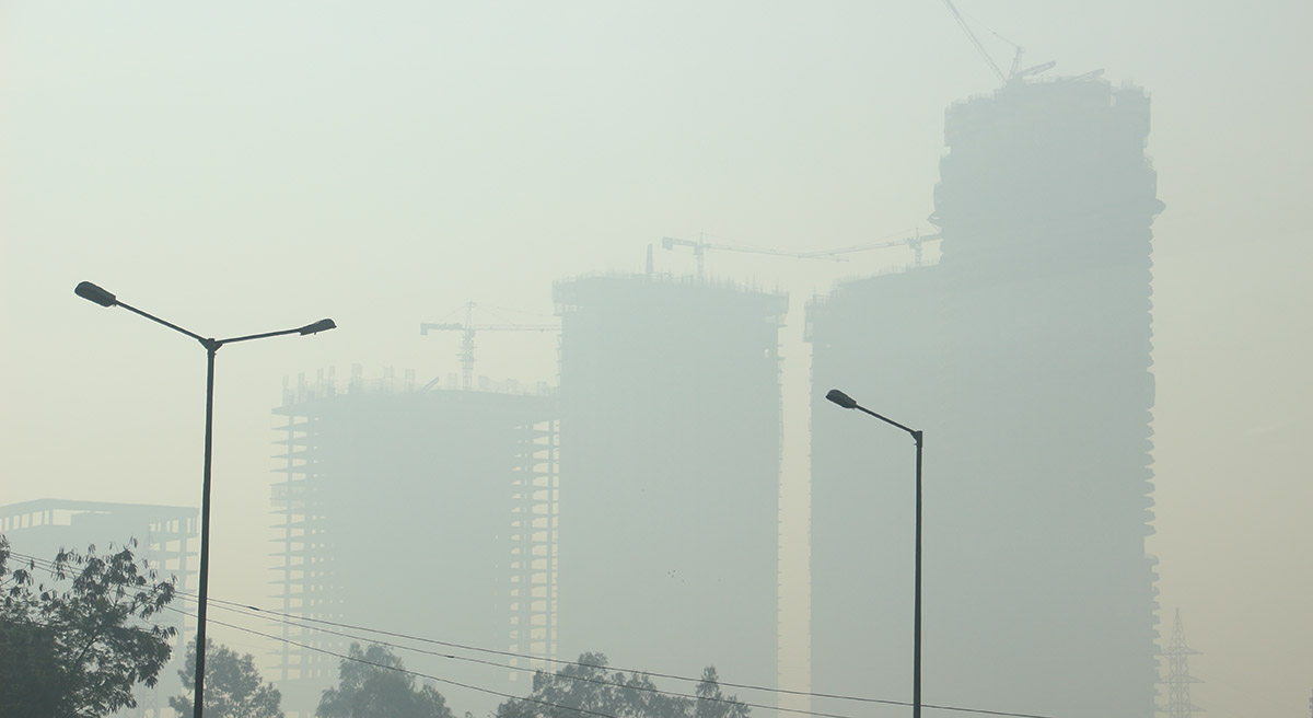
Every winter, a grey haze settles over many Indian cities. Schools close, hospitals see a rise in respiratory cases, and public debate intensifies over who is responsible for the pollution.
Yet the air around us remains largely invisible, complex, and difficult to understand. Where exactly does the pollution come from? How far does it travel? Why does it suddenly worsen in winter and improve during other seasons?
To answer these questions, scientists rely not only on monitoring stations but also on powerful atmospheric models. Among the most important of these is the Weather Research and Forecasting-Community Multiscale Air Quality (WRF–CMAQ) modeling system, a scientific tool that helps researchers simulate how pollution forms, moves, and transforms in the atmosphere.
Monitoring stations tell us what the air quality is at a specific location. But they cannot tell the full story. It is impossible to install sensors in every village, highway, industrial cluster, or agricultural field across a country as vast as India. Nor can we measure air pollution at every height in the atmosphere. This is where models help scientists “see” what cannot be directly measured.
At the foundation of this modeling system lies WRF, or the Weather Research and Forecasting model. Weather plays a crucial role in determining how pollution behaves. Wind can disperse pollutants across large distances, rainfall can wash them out of the air, and temperature inversions during winter can trap them close to the surface. WRF simulates these meteorological conditions by dividing the atmosphere into millions of small grids and calculating how wind, temperature, humidity, clouds, and atmospheric pressure change across space and time.
Understanding these weather dynamics is essential because air pollution does not behave randomly. Calm winds can cause pollution to accumulate, while stronger atmospheric mixing can disperse it. Without accurately representing weather patterns, it is impossible to realistically simulate air quality.
This is where the second component comes in: CMAQ, the Community Multiscale Air Quality model. While WRF simulates the weather, CMAQ simulates the chemistry and movement of pollutants. Air pollution is not simply smoke floating in the sky. It is a complex mixture of gases and microscopic particles that continuously react with sunlight and other chemicals in the atmosphere.
For example, nitrogen oxides emitted from vehicles can react under sunlight to form ground-level ozone. Sulphur dioxide released from power plants can transform into sulphate particles. Smoke from agricultural burning or forest fires can evolve into fine particulate matter (PM2.5) and travel hundreds of kilometres away. CMAQ represents these chemical transformations, tracks how pollutants move with the wind, and estimates how they eventually settle on land or water surfaces.
When WRF and CMAQ are combined, they provide a powerful framework to simulate real-world air pollution. WRF generates detailed meteorological fields, such as wind patterns, temperature structures, and atmospheric mixing heights, which CMAQ then uses to simulate emissions, chemical reactions, transport, and removal of pollutants.
This integration allows scientists to understand phenomena that cannot be explained by measurements alone. For instance, during winter in northern India, weak winds and shallow atmospheric mixing layers trap pollutants near the ground, often triggering severe pollution episodes. During summer, stronger vertical mixing can dilute pollution at the surface but carry pollutants to higher altitudes or distant regions. Similarly, smoke from crop residue burning or forest fires in one state can significantly influence air quality hundreds of kilometres away.
The modeling process itself involves several steps. Scientists first gather large datasets, including meteorological inputs, emission inventories from vehicles and industries, satellite observations of fires, and land-use information such as urban areas, forests, and agricultural land. WRF then simulates atmospheric conditions, and CMAQ uses this information to simulate pollutants such as PM2.5, ozone, nitrogen dioxide, sulphur dioxide, and carbon monoxide. Finally, the results are compared with ground-based monitoring data to ensure that the simulations realistically represent observed air quality.
For a country like India, such modeling tools are especially valuable. Rapid urbanization, industrial growth, expanding transportation networks, construction activities, and seasonal biomass burning all contribute to air pollution. Monitoring networks provide critical real-time information, but they are spatially limited. Models help bridge this gap by providing a regional perspective on how pollution spreads across cities, states, and even national boundaries.
In regions such as the Indo-Gangetic Plains, where some of the world’s most severe pollution episodes occur, understanding these dynamics is crucial. Pollution levels are often influenced not only by local emissions but also by long-range transport of pollutants across multiple states.
Ultimately, models like WRF–CMAQ do more than simulate pollution, they help policymakers evaluate potential solutions. Scientists can test scenarios such as reducing vehicle emissions, controlling industrial sources, or limiting crop burning, and estimate how these measures might improve air quality.
Air pollution may be invisible, but its consequences are painfully visible in our hospitals, our economy, and the shortening of lives across the country. Tackling it requires more than reacting to daily pollution numbers, it demands a deeper understanding of how pollution forms, moves, and accumulates across regions. Tools like the WRF–CMAQ modeling system provide exactly that insight. By revealing the hidden pathways of pollution and testing the potential impact of control measures before they are implemented, such models allow policymakers to move from reactive responses to informed, science-based strategies. In the fight for clean air, seeing the invisible may be our most powerful advantage.
In the broader debate on how we understand and respond to air pollution, the choice of model is not merely a technical preference, it shapes the very evidence on which policy rests. Models like AERMOD serve an important purpose at the local scale, and WRF-Chem brings valuable real-time coupling of atmospheric processes. Yet, for regional and long-term planning, CMAQ stands out for its ability to integrate emissions, chemistry, transport, and deposition within a flexible and computationally efficient framework. Its largely offline architecture allows policymakers and researchers to test multiple scenarios without re-running complex meteorology each time, a critical advantage in a world where decisions must be both timely and evidence based. That said, no model is inherently superior in all contexts. The strength of CMAQ, like any scientific tool, ultimately depends on the quality of the data that feed it. As we move toward more informed air quality management, the focus must therefore shift not only to better models, but to better emissions inventories, better meteorological inputs, and a more thoughtful alignment between scientific tools and policy needs.